
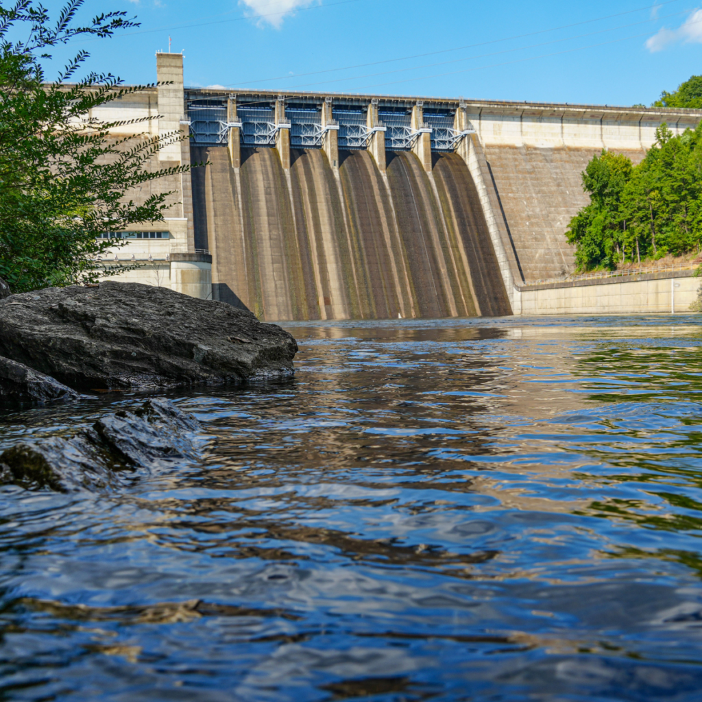
Every time water moves through Greers Ferry Dam, somebody has a reason to care.
A farmer downstream may be watching the river because his field has flooded before. A family with a lake house may be watching the lake level. A power customer may never see the dam, but still benefits when its turbines make electricity. A trout guide may be watching the same water, hoping it arrives far enough downstream, cold enough and long enough, to keep the Little Red River healthy.
All of them are looking at the same water. The challenge is that one drop cannot be used twice in the same moment. Once it leaves the lake, it may carry away floodwater, turn a turbine, or help the trout river—but it is no longer stored behind the dam.
That is why water management on the Little Red is complicated. It is also why the rules matter.
Start Here: The Three Reasons Water Is Released
At the simplest level, water is released from Greers Ferry Dam for only three reasons:
- Get rid of floodwater. When the lake rises into flood storage, the Corps releases that extra water as soon as the rivers below can safely hold it.
- Create electricity. SWPA sends water through the generators when power is needed.
- Help keep the river cold for trout. A written agreement calls for cold-water releases during the warm months.
Of course, the dam is not the only way water leaves Greers Ferry Lake. Some is drawn through pipes to supply water for homes and towns, and some evaporates into the air. This article focuses on water that leaves through Greers Ferry Dam.
Sometimes the same release does two jobs. Floodwater normally passes through the generators first, so it can make electricity on its way downstream. But one of these three needs is always behind the release: remove floodwater, make power, or help the trout river.
The third reason comes with a major problem. The written agreement creates a release rule, but it does not create a trout-water account inside the lake. Put plainly: Greers Ferry has a fishwater release rule, but it has no official storage allocation for trout water.
The operating plan does hold back some extra water with trout releases in mind. On May 1, the top of the conservation pool rises one foot, from 462.04 to 463.04 feet. It then drops to 462.54 feet by June 1 and stays there until October 1. This seasonal pool change helps cover the warm-season trout releases.
But a seasonal pool change is not the same as a formal storage allocation. Congress reallocated specific reservoir storage for minimum flow at Bull Shoals and Norfork. Greers Ferry received no such allocation. The Little Red has a seasonal rise and a seasonal release rule—but no dedicated storage account in the rule book to back them up.
That is where much of the challenge begins. When the lake is not holding floodwater, every stored drop is valuable. Water released today cannot make electricity later or help carry the lake through a dry summer. If more electricity is not needed, it can be difficult under the current rules to release much more trout water than the agreement requires because there is no separate supply waiting to be used for that purpose.
Those three reasons explain why water leaves the dam. The sections below explain how the system works, where the present rules fall short, and what should happen next.
The Dam Came First
Greers Ferry Dam was not built to create a trout stream. It was built mainly for flood control and hydroelectric power generation. Hydroelectric power is electricity made when falling water spins large turbines inside the dam. Commercial generation began in 1964.
Flood control came from painful experience. Before the dam, heavy rains could send water down the Little Red and into the lower White River system, threatening farms, homes, roads, and towns. Greers Ferry Lake created a place to temporarily store that floodwater and release it later, when downstream channels had room.
The dam also changed the river. Water released from deep in the lake was much colder than the free-flowing Little Red had been. Many native warmwater fish could no longer thrive immediately below the dam. The Arkansas Game and Fish Commission, or AGFC, began stocking Rainbow Trout in 1966 to replace lost fishing opportunity. With AGFC approval, Arkansas Fly Fishers planted Brown Trout eggs at Cow Shoals in 1975. Arkansas Fly Fishers and Mid-South Fly Fishers added fingerlings in 1978, helping establish the river’s wild, self-sustaining Brown Trout population.
That timing matters. In 1980, the Corps and SWPA signed a Memorandum of Understanding, or MOU. In simple terms, it is an agreement explaining how the two agencies will work together to operate the dam. The fishwater provision attached to that agreement put the first seasonal cold-water release requirement for the trout fishery into the dam’s operating rules. It did not reserve any water in the lake specifically for trout, but it gave the fishery a place in dam operations.
The agreement came only five years after the original egg planting and two years after the fingerlings were added. When it took effect, the fishery that would produce the world-record Brown Trout was still very young. The record catch was 12 years away. The river did not yet have the long record of natural spawning, survival, and trophy production that it has today. Managers were writing rules for a young tailwater trout fishery, not the proven wild Brown Trout fishery the Little Red would become.
The trout fishery was therefore both an unintended result of the dam and a public resource built in response to the dam’s effects. The 40-pound, 4-ounce Brown Trout caught in 1992 helped make the Heber Springs area an outdoor destination. But flood control and hydropower remained the project’s primary legal purposes. That history still shapes nearly every water decision today.
The Lake Is a Bank
The easiest way to understand Greers Ferry Lake is to picture it as a bank.
Water stored in the lake is an account balance. In the upper part of the reservoir, empty space is reserved to catch future floods. In the conservation pool—the lake’s normal operating range—stored water can support hydropower, water supply, recreation, and other project benefits.
Every drop also represents potential energy and potential money. When water passes through a turbine, the Southwestern Power Administration, or SWPA, can market the electricity to public power customers such as rural electric cooperatives and municipalities. Water is especially valuable when released during periods of high electricity demand.
That does not mean agencies see the lake as nothing but a cash register. It means water has an opportunity cost. A gallon released today cannot generate power next week or help maintain the lake during a drought. A gallon held too long during a wet period may reduce space needed for the next storm. A large release that helps one purpose can affect lake access, downstream land, wade fishing, or power production.
Like a careful banker, the system cannot spend the account on the loudest request of the day. It has to follow rules.
Why the Rules Are So Strict
The “rule book” is not one document. It includes federal law, the Greers Ferry Water Control Manual, the larger White River Basin plan, agreements between agencies, flood forecasts, lake zones, downstream river stages, equipment limits, and water-quality plans.
The U.S. Army Corps of Engineers, often called the Corps or USACE, regulates Greers Ferry Dam and Lake. It monitors rainfall, lake levels, downstream conditions, and flood risk. SWPA markets the power and helps schedule hydropower generation within the project’s operating limits. AGFC manages the trout fishery, studies fish and habitat, sets fishing regulations, and advises the federal agencies, but it does not operate the dam.
The rules are strict because the project serves people with different needs:
- Downstream farmers and landowners need protection from damaging floods, especially during planting and growing seasons.
- Lake residents, boaters, marinas, and visitors need usable lake levels and safe access.
- Cities and industries depend on stored water.
- Public power customers depend on reliable hydropower.
- River landowners, anglers, guides, resorts, and local businesses depend on a safe, healthy tailwater.
- Trout, aquatic insects, sculpins, and other river life depend on water that is cold, oxygenated, connected, and present at the right times.
No serious plan can pretend those interests do not exist. The goal is not to place trout above flood safety or to empty the lake for fishing. The goal is to give the river a clear, measurable place within a system designed to serve everyone.
What the MOU Gives the River
The fishwater rules are only one part of that much broader MOU. The agreement was signed on July 23, 1980, and also covers hydropower scheduling, reservoir operations, emergencies, maintenance outages, reports, environmental concerns, and other responsibilities. The fishwater agreement sits inside the detailed operating framework attached to the MOU. It is not the whole MOU.
An MOU is not the same as an act of Congress. It helps the agencies coordinate their work, but it does not give trout a share of the lake’s storage. The fishwater provision tells the agencies how much water to release under certain conditions. It does not set aside water in the conservation pool to guarantee those releases through every dry period.
From May 1 through October 15, the system engineer must schedule a daily volume of cold water for the trout fishery. The amount is based on the forecast air temperature at Calico Rock. The rule calls for 115 day-second-feet when the forecast is 90 degrees Fahrenheit or below, 150 when it is 91–95 degrees, 175 when it is 96–104 degrees, and 225 when it is 105 degrees or hotter.
A day-second-foot is a volume equal to one cubic foot per second, or cfs, flowing for 24 hours. Cfs measures the rate of moving water. The required volume must also be increased by 50 percent on one day in every three-day period.
Here is the weakness: the requirement is a daily volume, not a steady 24-hour flow. The Water Control Manual says that volume is generally released during one or two hours when SWPA can also meet peak power demand. The river may receive the correct amount on paper but still spend much of the day at very low flow.
The manual also recognizes that the Little Red has many shallow shoals, that warm-weather temperatures there can threaten trout, and that extra water may take as long as 24 hours to reach problem areas. Additional generation beyond the required amount is not guaranteed; it is discretionary when practical.
The agreement also protects too short a piece of river by today’s standards. The Corps’ Water Control Manual describes the coldwater fishery as about 22 miles long, ending at Pangburn. Pangburn is the downstream checkpoint: managers watch the temperature gage there and decide whether more water is needed to keep the river below 75 degrees Fahrenheit.
But 75 degrees is a survival ceiling, not a healthy-water goal. The manual itself warns that long periods above 75 degrees can kill trout. Recent Little Red River research says biologists become concerned about the overall health of Brown Trout when daily average water temperature rises above 19 degrees Celsius, or about 66 degrees Fahrenheit. Holding the river just under 75 may meet the old rule while still leaving trout under serious stress.
In other words, the MOU was an important step forward in 1980. It created seasonal fishwater protection. But its biggest shortcoming is simple: it does not call for enough water to maintain a stable, healthy trout fishery. It is closer to a safeguard against a major fish kill than a plan for keeping the whole river healthy. It also provides a daily volume instead of steady flow, centers protection on only the first 22 miles, and uses 75 degrees as its upper limit.
A 2025 University of Arkansas at Pine Bluff report coauthored by Dr. Steve Lochmann shows how large that gap can be. Using conditions when water at Highway 305 was warmer than 66 degrees, the researchers modeled the water needed to cool it by just 3.6 degrees. They found: “The discharges required to lower water temperature 2 ºC at the Highway 305 Bridge were between 20 and 56 times higher than fish water releases.” Those larger releases would also need to continue for two days instead of the one day called for by the current fishwater rule.
That does not mean managers should simply release 20 to 56 times more water every day. It means the old rule was not designed to maintain a modern healthy-water goal far downstream. A better plan must use actual river temperature, distance downstream, timing, and the cold water available in the lake to decide how much water is needed.
These rules are not frozen forever. The MOU says its detailed operating arrangements can be amended with written approval from the Corps and SWPA. The operating arrangement also says it may be amended with the mutual written consent of both parties. In simple terms, the fishwater rules can be improved—but the two federal agencies must agree to the change in writing.
The manual also includes a 1986 draft operating arrangement. A note in the manual says both parties never formally signed that draft, although the Corps’ Southwestern Division made it official operations policy. In 2026, that framework is 40 years old. A rule is not wrong simply because it is old. But a 40-year-old fishwater plan—written before today’s wild Brown Trout fishery and before modern temperature modeling—should not be treated as the last word. It is time for a formal review and update.
Minimum Flow Was Studied—but Not Authorized
Congress opened a larger door in the late 1990s and early 2000s by directing the Corps to study minimum flows at five White River Basin reservoirs, including Greers Ferry. Minimum flow means a dependable amount of water released below a dam even when the main turbines are not generating.
The 2004 White River Minimum Flows Reallocation Study examined ways to provide that water. The people who studied the Little Red believed dependable minimum flow would make the river much better. Their judgment was not a weak maybe. In plain English, they gave minimum flow two thumbs up. The later Environmental Impact Statement says the study found the plan economically justified, technically sound, and environmentally acceptable.
For Greers Ferry, the study used a target of 200 cfs. Cfs means cubic feet per second. In plain terms, the plan aimed to keep 200 cubic feet of water moving past the dam every second when larger flood or power releases were not happening. AGFC selected that number because its studies showed 200 cfs would keep an important amount of the river channel covered with water.
It was a set target, but it was not an absolute guarantee. The Corps estimated that the water set aside for minimum flow would be enough about 80 to 90 percent of the time. During an extreme drought, that stored water could run out, and minimum flow could stop until the lake refilled.
The biological idea was simple. Keeping more river bottom covered for more time increases the wetted perimeter—the part of the channel that stays underwater. Wet shoals produce aquatic insects. They connect pools and runs. They protect places where Brown Trout dig nests, called redds, in clean gravel. They help moderate temperature and support dissolved oxygen, the oxygen mixed into water that fish and eggs need to survive.
But 200 cfs would not have been an automatic fix for warm water. Newer temperature modeling shows that the river’s temperature changes with the temperature of the water leaving the dam, air temperature, flow, rainfall, season, and distance downstream. That means a steady 200 cfs could help keep habitat wet and carry cold water downstream, but it could not promise safe temperatures at every river mile on every hot day. That is a reasonable conclusion from the newer model; the old study did not test the 200-cfs target with today’s temperature model.
In 2006, Congress authorized minimum-flow projects only at Bull Shoals and Norfork. It did not authorize Greers Ferry, Beaver, or Table Rock, and it repealed the earlier study authority that could have advanced those alternatives.
That distinction matters. Greers Ferry minimum flow did not fail because the study found it unnecessary or unworkable. The study concluded it would improve the river and identified workable ways to provide it. The Little Red reached the door but did not get through it. Neither the law nor the Corps’ final environmental review gives a reason or justification for leaving the Little Red out. No written explanation has been found elsewhere in the public record.
What Is Being Done Now—and What It Cannot Do
Two current efforts can help build a better path.
The first is the Little Red River Foundation’s pursuit of the Sustainable Rivers Program, or SRP. SRP is a partnership between the Corps and The Nature Conservancy that looks for ways existing dams can better serve both people and nature without ignoring their authorized purposes. In September 2025, the U.S. House unanimously approved an amendment supporting full and fair consideration of the Little Red’s SRP application.
That support is meaningful, but an application is not the same as a completed designation or a new operating rule. If the Little Red enters the program, agencies and stakeholders will still have to define ecological needs, test possible operations, measure results, and decide what changes are practical.
SRP is not an automatic fix. It can bring the right people together, organize the science, test release patterns, and build support for better operations. But SRP cannot amend the Corps-SWPA fishwater agreement by itself. A lasting change to that agreement still requires the Corps and SWPA to sit down together and approve new language in writing. If the final plan also requires dedicated trout-water storage or a new authorized project purpose, congressional action may still be needed.
The second effort is a new temperature-prediction model developed through recent AGFC-supported research. Researchers placed 14 temperature loggers along roughly 78 kilometers—about 48 miles—of the Greers Ferry Tailwater and lower Little Red River. They used air temperature, dam-release temperature, discharge, rainfall, distance from the dam, and seasonal conditions to predict water temperature. The warming-season model explained 77 percent of the variation in observed temperatures; the cooling-season model explained 64 percent.
That model does not operate the dam. It is a decision tool. It can help managers ask better questions: How much water is needed? When should it be released? How far downstream will the cold-water benefit travel? Will a short pulse arrive before or after a dangerous temperature develops?
The model is a strong first step, but the practical answer is not finished. Managers still need a tested, public guide that says how much water should be released, how long it should run, how early it must begin, and what river reach it will protect under different lake and weather conditions. AGFC-supported research is still building that answer. Four decades after the current operating framework was written, that applied work is overdue.
SRP can provide a process. The model can provide evidence. Together, they offer a better foundation than guesswork or a distant air-temperature forecast alone.
What Must Be Done
First, AGFC and the Corps must clearly define the river they are trying to protect—and use the same definition.
The Corps’ Water Control Manual describes a 22-mile coldwater fishery ending at Pangburn. AGFC manages the Greers Ferry Tailwater from just below the dam to the Monaghan-Womack Access at Highway 305, commonly described as about 30 miles. That leaves roughly eight miles of state-managed trout water below the Corps’ stated endpoint.
A line on a management map does not stop a trout or cold water. Recent research followed river conditions for roughly 48 miles from the dam toward Searcy and studied where the coldwater fishery changes into a warmwater fishery. Trout and coldwater influence can continue below Highway 305 and sometimes toward Searcy.
The Corps and AGFC should put one shared definition in writing. It should identify the main trout-management reach, the farther-downstream transition area, and the temperature and flow goals for each part. That does not mean every mile to Searcy must be managed exactly the same way. It means everyone should know where the protected tailwater ends, where monitoring continues, and how success will be measured. Until the agencies agree on that, disputes are almost guaranteed.
Second, the Little Red needs year-round fishwater designed to maintain river function. The present MOU mainly protects seasonal temperature from May through mid-October. Brown Trout spawn in fall and winter. Eggs remain in the gravel for weeks. Aquatic insects need wet habitat throughout the year. A shoal that repeatedly dries does not provide the same food production, spawning security, or connected habitat as one that remains wetted.
Year-round fishwater does not have to mean a single unchanging release. A modern plan could use seasonal targets, maximum no-flow periods, temperature triggers, dissolved-oxygen safeguards, spawning protection, and carefully tested pulses. The goal should be clear: maintain enough wetted perimeter for shoals to function while preserving flood safety, lake use, water supply, and reasonable hydropower value.
How We Get There
The path forward is cooperation backed by specific requests.
At the agreement level, the signature path is simple: bring the Corps and SWPA to the same table. AGFC must provide the fishery goals and the best available science. Researchers, anglers, communities, and other agencies can help shape and support the plan. But the Corps and SWPA are the two parties that must agree in writing to amend the current fishwater arrangement. The technical and legal questions may be difficult, but the responsible parties are clear.
The Corps, SWPA, AGFC, U.S. Fish and Wildlife Service, U.S. Geological Survey, The Nature Conservancy, local governments, farmers, lake interests, river landowners, guides, businesses, and conservation groups should work from one shared set of facts. That group should use the SRP process and the new temperature model to test release patterns under wet, normal, and drought conditions.
The public should ask for five concrete outcomes:
- One written definition, agreed upon by AGFC and the Corps, of the tailwater, its managed trout reach, and its downstream transition area.
- Year-round biological goals for temperature, dissolved oxygen, wetted perimeter, shoal health, and Brown Trout spawning.
- A written Corps-SWPA amendment modernizing the fishwater rules with current Little Red River data.
- Public modeling of the lake-level, flood-control, hydropower, and downstream effects of proposed releases.
- A pilot operation with monitoring, published results, and a clear path to formal adoption if it works.
A System That Works—and Can Improve
The present system is not perfect. But it does the dam’s two main jobs: control floods and make electricity. The old floods explain why the rules are careful. Nature is hard to predict, and these safeguards protect people, farms, roads, homes, and towns.
As the years pass, it is easy to forget how serious those floods were. We have also learned more about the Little Red and the value of its trout fishery to Arkansas. That does not mean throwing out the rule book or putting people at risk. It means using better information to carefully improve the parts that can be improved.
That work will take patience, cooperation, and honesty about the tradeoffs. It may require an updated MOU, new operating guidance, congressional action, funding, or some mix of those steps.
There is room for hope. A more fine-tuned system can protect flood space, keep making power, and give trout more dependable water when conditions allow. The goal does not have to be the lake against the river. It can be a safer, smarter plan that serves both—and gives anglers and trout a healthier Little Red.
Sources
- U.S. Army Corps of Engineers, Greers Ferry Dam and Lake Water Control Manual (October 2022).
- U.S. Army Corps of Engineers, White River Minimum Flows Reallocation Study Report (July 29, 2004).
- U.S. Army Corps of Engineers, White River Basin, Arkansas, Minimum Flows Final Environmental Impact Statement (January 2009).
- Arkansas Game and Fish Commission, Greers Ferry Tailwater (Little Red River).
- Arkansas Fly Fishers, How AFF was part of bringing Brown Trout to the Little Red.
- Olhausen, Wall, and Lochmann, An Evaluation of the Trout Fishery in the Little Red River (2025 final report).
- U.S. Rep. French Hill, Little Red River Sustainable Rivers Program amendment announcement, September 5, 2025.
- The Nature Conservancy, Sustainable Rivers Program.
Really great article! It appears things are on the right track but it is a long one. Another area of concern is the low growth rate of Brown Trout that I believe has been identified by Dr. Lochmann as one inch per year. The former world record Brown trout was obviously an anomaly super fish but it definitely had a much higher growth rate of over three inches per year. A more constant flow of cold water would hopefully help increase the growth rates.
There may be other important considerations to consider.
1. Minimum flow regulation.
2.Strict guidelines for sewage and contaminated in-flow from the 175+ homes/cabins between the dam and highway 305. Contaminated at https://www.mainefarmhousebrands.com/blogs/skincare-science/10-toxic-ingredients-in-soap-and-skincare-products-you-should-avoid.
Having found worms and parasites in the trout at Lower Ramsey in 2021, it is a relatively new development in trout health. Having fished on the LR since 1973, I see the loss of water clarity, loss of sow bugs, and other invertabrates.
Basically we are poisoning our River.
After boasting 8k trout per mile, until the loss of trout stockings, we have one of the finest southern trout streams in the world. We need to wake up and respect this, our glorious trout stream.
P.S. Hiring a woman to lead trout management, who had never caught a trout, nor had a any real experience, explains some of the knucklehead decisions that plague the fishery.
Love the Little Red & White River, I’ve seen the benefits of minimum flow on the White and would love the same for the Little Red.
I’d love to be a part of further efforts in keeping a clean, clear, cold Little Red River and an amazing fishery improve for all to enjoy.